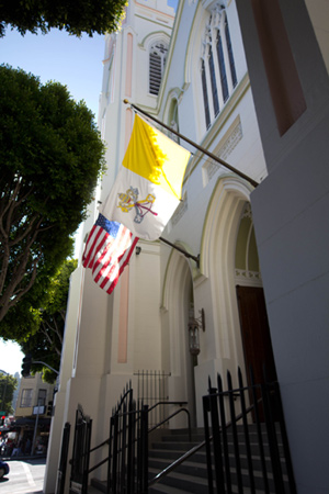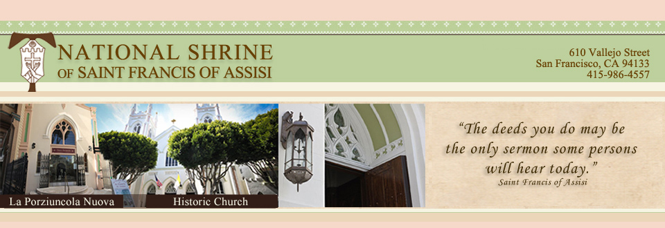
National Shrine of Saint Francis of Assisi
610 Vallejo Street @ Columbus Avenue
San Francisco, CA 94133
Do buses go near the Shrine?
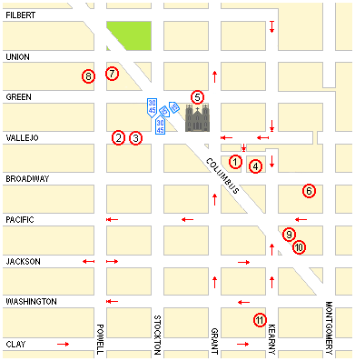
Yes. The 30 and 45 lines both stop on Stockton at Green. The 8BX line stops on Columbus at Green. See the map below.
For more information about routing and schedules, see San Francisco Muni Schedules.
Where can I find parking?
Finding parking on the street in the North Beach area can be difficult, but you might get lucky. You might also want to consider any of the following public parking garages/lots (loosely organized by walking distance from the Shrine — the numbers are keyed to the map above).
 Vallejo Street (Pacific Park Management)
- 766 Vallejo between Stockton/Columbus and Powell (415-989-4490)
The garage is next to the Police Station on the north side of the street.
 North Beach (Pacific Park Management)
- 755 Vallejo between Stockton/Columbus and Powell (415-399-9564)
The garage is on the south side of the street across from the Police Station.
- Both garages:
- Open 24 hours
- Handicap spaces are available, but the rates are not discounted.
- Rates: $3 per hour for 1-2 hrs
 Little Joe's Lot (open lot)
- 530 Broadway between Columbus and Kearny
 Parking lot behind the Shrine
- 535 Green Street, between Columbus and Grant Avenues
- 10 a.m. to 10 p.m.
 Imperial Parking
- 425 Broadway between Kearny and Montgomery
 1636 Powell Street Garage
- 1636 Powell between Union and Green
- Tel: 415-986-3937
 170 Columbus Garage
- 170 Columbus on the east side between Jackson and Broadway
- Tel: 415-421-6057
 AMPCO System Parking (large open lot accessed by a driveway)
- 528 Jackson at Columbus
(The entrance is actually off the east side of Columbus, just north of Jackson)
Getting to the Shrine from BART
Three of the most direct possibilities are as follows:
- In the true penitential spirit of Saint Francis, you can walk.
Take BART to the Montgomery Street station. The underground station has seven different locations of stairs to street level, marked with B's on the map above. Take any exit, use the map to orient yourself, and walk north up Montgomery Street. Follow Montgomery Street to Columbus Avenue; the Transamerica "Pyramid" Building marks the corner. Then walk up Columbus Avenue to Vallejo Street.
The walk goes through a safe section of town (from Downtown, through the Financial District, to the Italian North Beach neighborhood) and takes about 15-20 minutes at a moderately brisk pace. - You can take a bus.
Walk from the Montgomery Street BART station west along Market Street for one block to Kearny Street; turn right on Kearny, and about a half block from the corner you will find a MUNI bus stop. You can take the 30, 45, or 8BX lines. Regardless of which bus you take, get off at Green Street. (If you feel unsure about the stop, ask the bus driver for help.) See the small map in this section to locate the MUNI bus stop relative to the BART station; see the larger map above to find the bus stops near the Shrine. - You can use Uber & Lyft or you can take a taxi cab.
If you prefer to take a taxi instead of calling Uber or Lyft and if you have any difficulty finding a cab near the Montgomery Street BART station, go to the corner of Market Street and New Montgomery Street and you will find a taxi stand in front of the Sheraton Palace Hotel. Tell the driver you want to go to North Beach at the corner of Columbus and Vallejo.

Finding Us/Parking